 CHIQUITA EXPLORER
Current Status
Where is the vessel?
CHIQUITA EXPLORER is currently in 37 nm SE of West Ocean City, based on AIS data received about 15h ago.
Latest AIS update:
Current position: 37.83304° N, 74.59939° W (37 nm SE of West Ocean City)
Average speed (last 7 days): Loading…
Average speed (last 30 days): Loading…
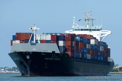
Vessel profile: CHIQUITA EXPLORER is a Container Ship with dimensions m x m.
This page combines live AIS, route history, probable destination signals, nearby traffic, and port activity for practical vessel monitoring.
The current position of vessel CHIQUITA EXPLORER is 37.83304 lat / -74.59939 lng. Updated: 2026-05-18 20:03:36 UTCNearest reference points:
- 24 nm E of West Ocean City
- 57 nm E of Fenwick Island
- Near Slaughter Beach
Currently sailing under the flag of Liberia ![]()
Details:
Live Vessel CHIQUITA EXPLORER Analytics (details, animations, etc.)
Recent AIS points (UTC):
2026-05-18 16:47:01 UTC · 37.18476, -74.63708 · SOG 12.6 kn · COG 2°2026-05-18 17:35:20 UTC · 37.34497, -74.62808 · SOG 11.7 kn · COG 2°
2026-05-18 19:38:39 UTC · 37.75082, -74.60665 · SOG 12 kn · COG 6°
2026-05-18 20:03:36 UTC · 37.83304, -74.59939 · SOG 11.9 kn · COG 6°