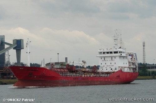
 ADIYAMAN
Current Status
Where is the vessel?
ADIYAMAN is currently in Near Bridge of Don, based on AIS data received about 14h ago.
Latest AIS update:
Current position: 57.18015° N, 2.03117° W (Near Bridge of Don)
Average speed (last 7 days): Loading…
Average speed (last 30 days): Loading…
Vessel profile: ADIYAMAN is a Oil/Chemical Tanker with dimensions m x m.
This page combines live AIS, route history, probable destination signals, nearby traffic, and port activity for practical vessel monitoring.
The current position of vessel ADIYAMAN is 57.18015 lat / -2.03117 lng. Updated: 2026-05-23 01:37:15 UTCNearest reference points:
- Near Aberdeen
- Near PETERHEAD
- Near Peterhead
Currently sailing under the flag of Portugal ![]()
Details:
Live Vessel ADIYAMAN Analytics (details, animations, etc.)
Recent AIS points (UTC):
2026-05-22 22:33:58 UTC · 57.18031, -2.02988 · SOG 0.1 kn · COG 200°2026-05-22 23:47:26 UTC · 57.18033, -2.03060 · SOG 0.1 kn · COG 174°
2026-05-23 01:32:29 UTC · 57.18015, -2.03117 · SOG 0.1 kn · COG 150°
2026-05-23 01:37:15 UTC · 57.18015, -2.03117 · SOG 0.1 kn · COG 150°