 vesseltracker.com
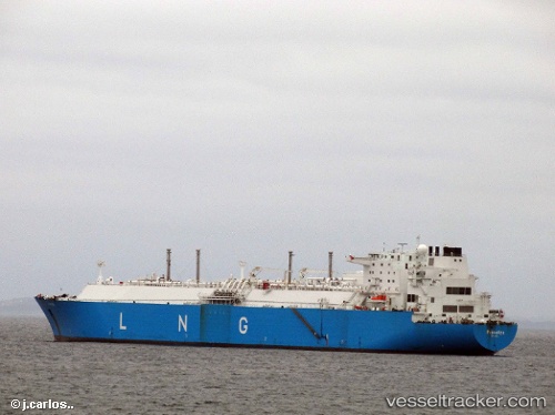
 KARADENIZ LNGT POWERSHIP ANATOLIA
Current Status
Where is the vessel?
KARADENIZ LNGT POWERSHIP ANATOLIA is currently in Near YALOVA, based on AIS data received about 12d ago.
Latest AIS update:
Current position: 40.70582° N, 29.46436° E (Near YALOVA)
Average speed (last 7 days): Loading…
Average speed (last 30 days): Loading…
Vessel profile: KARADENIZ LNGT POWERSHIP ANATOLIA is a LNG Tanker with dimensions 290m x 43m.
This page combines live AIS, route history, probable destination signals, nearby traffic, and port activity for practical vessel monitoring.
The current position of vessel KARADENIZ LNGT POWERSHIP ANATOLIA is 40.70582 lat / 29.46436 lng. Updated: 2026-05-06 11:03:22 UTCNearest reference points:
- Near YALOVA
- Near Yilport
- Near Diliskelesi
Currently sailing under the flag of Liberia ![]()
KARADENIZ LNGT POWERSHIP ANATOLIA built in 2006 year
Deadweight:
86385 tDetails:
Live Vessel KARADENIZ LNGT POWERSHIP ANATOLIA Analytics (details, animations, etc.)
Recent AIS points (UTC):
2026-05-06 11:03:22 UTC · 40.70582, 29.46436 · SOG 0 kn · COG 111°2026-05-06 11:03:22 UTC · 40.70582, 29.46436 · SOG 0 kn · COG 111°
2026-05-06 11:03:22 UTC · 40.70582, 29.46436 · SOG 0 kn · COG 111°
2026-05-06 11:03:22 UTC · 40.70582, 29.46436 · SOG 0 kn · COG 111°