 vesseltracker.com
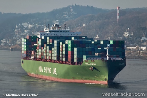
 Le Havre
Current Status
Where is the vessel?
Le Havre is currently in 146 nm SE of António Enes, based on AIS data received about 14h ago.
Latest AIS update:
Current position: 18.20389° S, 41.37543° E (146 nm SE of António Enes)
Average speed (last 7 days): Loading…
Average speed (last 30 days): Loading…
Vessel profile: Le Havre is a Container Ship with dimensions 337m x 45m.
This page combines live AIS, route history, probable destination signals, nearby traffic, and port activity for practical vessel monitoring.
The current position of vessel Le Havre is -18.20389 lat / 41.37543 lng. Updated: 2026-05-17 19:55:58 UTCNearest reference points:
- 229 nm SE of Quelimane
Currently sailing under the flag of Cyprus ![]()
Le Havre built in 2006 year
Deadweight:
111737 tDetails:
Live Vessel Le Havre Analytics (details, animations, etc.)
Recent AIS points (UTC):
2026-05-17 16:12:17 UTC · -19.20623, 40.58238 · SOG 19.7 kn · COG 45°2026-05-17 17:58:21 UTC · -18.73581, 40.95459 · SOG 20 kn · COG 35°
2026-05-17 19:18:45 UTC · -18.37248, 41.24055 · SOG 20.4 kn · COG 35°
2026-05-17 19:55:58 UTC · -18.20389, 41.37543 · SOG 20.6 kn · COG 35°