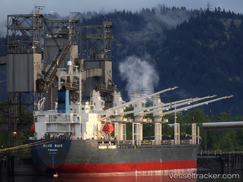
 Blue Baie
Current Status
Where is the vessel?
Blue Baie is currently in 13 nm S of Kumport, based on AIS data received about 14h ago.
Latest AIS update:
Current position: 40.72892° N, 28.77367° E (13 nm S of Kumport)
Average speed (last 7 days): Loading…
Average speed (last 30 days): Loading…
Vessel profile: Blue Baie is a General Cargo Ship with dimensions 171m x 27m.
This page combines live AIS, route history, probable destination signals, nearby traffic, and port activity for practical vessel monitoring.
The current position of vessel Blue Baie is 40.72892 lat / 28.77367 lng. Updated: 2026-05-18 20:03:53 UTCNearest reference points:
- 16 nm S of Kumport
- 17 nm S of Kumport
- Near Kumport
Currently sailing under the flag of Panama ![]()
Blue Baie built in 2006 year
Deadweight:
31734 tDetails:
Live Vessel Blue Baie Analytics (details, animations, etc.)
Recent AIS points (UTC):
2026-05-18 16:51:54 UTC · 40.73602, 28.73782 · SOG 0.4 kn · COG 222°2026-05-18 18:22:52 UTC · 40.73302, 28.75395 · SOG 0.4 kn · COG 192°
2026-05-18 19:29:40 UTC · 40.73033, 28.76677 · SOG 0.5 kn · COG 138°
2026-05-18 20:03:53 UTC · 40.72892, 28.77367 · SOG 0.5 kn · COG 115°