 Lng Imo
Current Status
Where is the vessel?
Lng Imo is currently in 98 nm W of Ankokoambo, based on AIS data received about 17h ago.
Latest AIS update:
Current position: 16.16907° S, 42.82144° E (98 nm W of Ankokoambo)
Average speed (last 7 days): Loading…
Average speed (last 30 days): Loading…
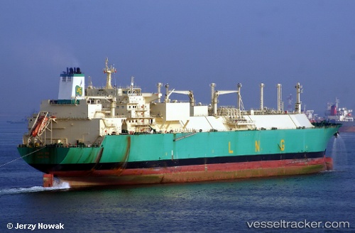
Vessel profile: Lng Imo is a Lng Tanker with dimensions 288m x 44m.
This page combines live AIS, route history, probable destination signals, nearby traffic, and port activity for practical vessel monitoring.
The current position of vessel Lng Imo is -16.16907 lat / 42.82144 lng. Updated: 2026-05-21 22:18:46 UTCNearest reference points:
- Near NACALA PORTO
- 10 nm N of NACALA PORTO
Currently sailing under the flag of Bermuda ![]()
Lng Imo built in 2007 year
Deadweight:
83688 tDetails:
Live Vessel Lng Imo Analytics (details, animations, etc.)
Recent AIS points (UTC):
2026-05-21 19:04:13 UTC · -16.53877, 42.14478 · SOG 13.8 kn · COG 60°2026-05-21 20:15:02 UTC · -16.40121, 42.38784 · SOG 14 kn · COG 67°
2026-05-21 22:03:11 UTC · -16.20297, 42.77140 · SOG 13.3 kn · COG 59°
2026-05-21 22:18:46 UTC · -16.16907, 42.82144 · SOG 13.6 kn · COG 61°