 KRASNOYARSK
Current Status
Where is the vessel?
KRASNOYARSK is currently in 43 nm W of Gibraltar, based on AIS data received about 14h ago.
Latest AIS update:
Current position: 36.23500° N, 7.23667° W (43 nm W of Gibraltar)
Average speed (last 7 days): Loading…
Average speed (last 30 days): Loading…
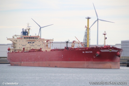
Vessel profile: KRASNOYARSK is a Oil Products Tanker with dimensions m x m.
This page combines live AIS, route history, probable destination signals, nearby traffic, and port activity for practical vessel monitoring.
The current position of vessel KRASNOYARSK is 36.23500 lat / -7.23667 lng. Updated: 2026-05-20 22:11:32 UTCNearest reference points:
- 45 nm W of Gibraltar
- 42 nm S of Faro
- Near La Antilla
Currently sailing under the flag of Russia ![]()
Details:
Live Vessel KRASNOYARSK Analytics (details, animations, etc.)
Recent AIS points (UTC):
2026-05-20 16:51:51 UTC · 35.95619, -6.24421 · SOG 11.8 kn · COG 269°2026-05-20 17:32:51 UTC · 35.97598, -6.37339 · SOG 9.2 kn · COG 290°
2026-05-20 21:55:59 UTC · 36.22027, -7.19030 · SOG 9.4 kn · COG 290°
2026-05-20 22:11:32 UTC · 36.23500, -7.23667 · SOG 9 kn · COG -1°