 LI DA XING
Current Status
Where is the vessel?
LI DA XING is currently in Near Santos, based on AIS data received about 14h ago.
Latest AIS update:
Current position: 23.92844° S, 46.33354° W (Near Santos)
Average speed (last 7 days): Loading…
Average speed (last 30 days): Loading…
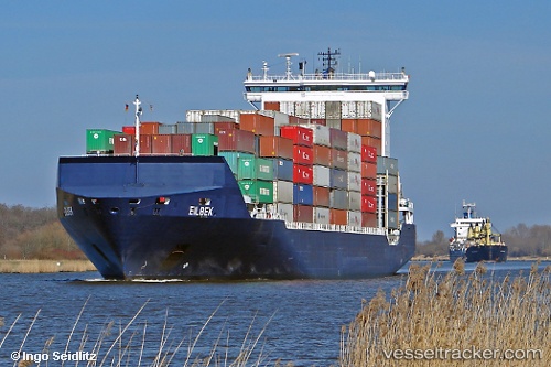
Vessel profile: LI DA XING is a Container Ship with dimensions m x m.
This page combines live AIS, route history, probable destination signals, nearby traffic, and port activity for practical vessel monitoring.
The current position of vessel LI DA XING is -23.92844 lat / -46.33354 lng. Updated: 2026-05-20 05:56:52 UTCNearest reference points:
- Near Santos
- Near Guarujá
- 30 nm SE of Guarujá
Currently sailing under the flag of Marshall Islands ![]()
Details:
Live Vessel LI DA XING Analytics (details, animations, etc.)
Recent AIS points (UTC):
2026-05-20 02:11:55 UTC · -23.92843, -46.33358 · SOG 0 kn · COG 78°2026-05-20 03:23:54 UTC · -23.92842, -46.33355 · SOG 0 kn · COG 76°
2026-05-20 04:32:54 UTC · -23.92841, -46.33352 · SOG 0 kn · COG 77°
2026-05-20 05:56:52 UTC · -23.92844, -46.33354 · SOG 0 kn · COG 76°