 GELIBOLU
Current Status
Where is the vessel?
GELIBOLU is currently in 23 nm NW of ALDERNEY, based on AIS data received about 15h ago.
Latest AIS update:
Current position: 50.05902° N, 2.46712° W (23 nm NW of ALDERNEY)
Average speed (last 7 days): Loading…
Average speed (last 30 days): Loading…
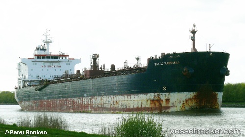
Vessel profile: GELIBOLU is a Oil/Chemical Tanker with dimensions m x m.
This page combines live AIS, route history, probable destination signals, nearby traffic, and port activity for practical vessel monitoring.
The current position of vessel GELIBOLU is 50.05902 lat / -2.46712 lng. Updated: 2026-05-18 21:27:45 UTCNearest reference points:
- 23 nm NW of Saint Sampson
- Near ALDERNEY
- Near Castletown
Currently sailing under the flag of Panama ![]()
Details:
Live Vessel GELIBOLU Analytics (details, animations, etc.)
Recent AIS points (UTC):
2026-05-18 18:00:05 UTC · 50.19266, -1.69448 · SOG 11.3 kn · COG 249°2026-05-18 19:38:56 UTC · 50.11807, -2.09320 · SOG 8.3 kn · COG 255°
2026-05-18 20:01:25 UTC · 50.10651, -2.17070 · SOG 8 kn · COG 255°
2026-05-18 21:27:45 UTC · 50.05902, -2.46712 · SOG 8.7 kn · COG 253°