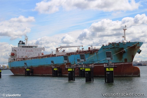
 Maersk Marmara
Current Status
Where is the vessel?
Maersk Marmara is currently in 77 nm S of Quintana, based on AIS data received about 14h ago.
Latest AIS update:
Current position: 27.68719° N, 94.86077° W (77 nm S of Quintana)
Average speed (last 7 days): Loading…
Average speed (last 30 days): Loading…
Vessel profile: Maersk Marmara is a Chemical Oil Products Tanker with dimensions 183m x 32m.
This page combines live AIS, route history, probable destination signals, nearby traffic, and port activity for practical vessel monitoring.
The current position of vessel Maersk Marmara is 27.68719 lat / -94.86077 lng. Updated: 2026-05-22 06:33:51 UTCNearest reference points:
- 63 nm SE of Quintana
- 56 nm SE of Quintana
- 49 nm SE of Sheppard
Currently sailing under the flag of Singapore ![]()
Maersk Marmara built in 2006 year
Deadweight:
51182 tDetails:
Live Vessel Maersk Marmara Analytics (details, animations, etc.)
Recent AIS points (UTC):
2026-05-22 02:38:01 UTC · 27.63638, -95.80727 · SOG 13.3 kn · COG 161°2026-05-22 03:33:21 UTC · 27.63259, -95.58716 · SOG 13.5 kn · COG 85°
2026-05-22 04:52:55 UTC · 27.65418, -95.26121 · SOG 12.9 kn · COG 84°
2026-05-22 06:33:51 UTC · 27.68719, -94.86077 · SOG 12.8 kn · COG 88°