 ECUADOR PROSPERITY
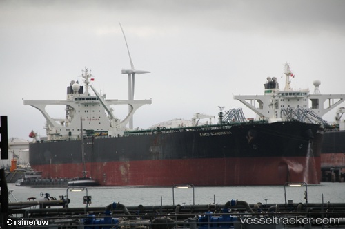
Current Status
Where is the vessel?
ECUADOR PROSPERITY is currently in 13 nm E of AL DUQM, based on AIS data received about 14h ago.
Latest AIS update:
Current position: 19.74630° N, 57.91435° E (13 nm E of AL DUQM)
Average speed (last 7 days): Loading…
Average speed (last 30 days): Loading…
Vessel profile: ECUADOR PROSPERITY is a Crude Oil Tanker with dimensions m x m.
This page combines live AIS, route history, probable destination signals, nearby traffic, and port activity for practical vessel monitoring.
The current position of vessel ECUADOR PROSPERITY is 19.74630 lat / 57.91435 lng. Updated: 2026-05-19 14:08:53 UTCNearest reference points:
- Near AL DUQM
- Near Duqm
- 39 nm SE of Pizhou
Currently sailing under the flag of Liberia ![]()
Details:
Live Vessel ECUADOR PROSPERITY Analytics (details, animations, etc.)
Recent AIS points (UTC):
2026-05-19 10:24:11 UTC · 19.74500, 57.91333 · SOG 0 kn · COG -1°2026-05-19 12:05:53 UTC · 19.74623, 57.91394 · SOG 0 kn · COG 171°
2026-05-19 13:44:53 UTC · 19.74631, 57.91426 · SOG 0 kn · COG 175°
2026-05-19 14:08:53 UTC · 19.74630, 57.91435 · SOG 0.1 kn · COG 178°