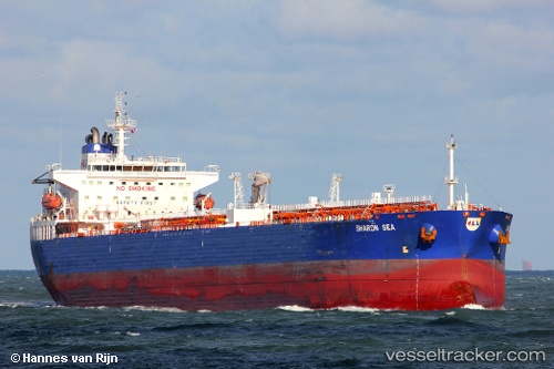
 CHEMTRANS NOVA
Current Status
Where is the vessel?
CHEMTRANS NOVA is currently in 94 nm E of Chapineria, based on AIS data received about 14h ago.
Latest AIS update:
Current position: 39.99833° N, 39.34833° W (94 nm E of Chapineria)
Average speed (last 7 days): Loading…
Average speed (last 30 days): Loading…
Vessel profile: CHEMTRANS NOVA is a Crude Oil Tanker with dimensions m x m.
This page combines live AIS, route history, probable destination signals, nearby traffic, and port activity for practical vessel monitoring.
The current position of vessel CHEMTRANS NOVA is 39.99833 lat / -39.34833 lng. Updated: 2026-05-19 11:30:39 UTCNearest reference points:
- 97 nm SE of Chapineria
Currently sailing under the flag of Antigua and Barbuda ![]()
Details:
Live Vessel CHEMTRANS NOVA Analytics (details, animations, etc.)
Recent AIS points (UTC):
2026-05-19 08:13:02 UTC · 40.00075, -38.91040 · SOG 8.3 kn · COG 275°2026-05-19 09:27:03 UTC · 40.00128, -39.11299 · SOG 5 kn · COG 270°
2026-05-19 10:49:02 UTC · 40.00228, -39.26958 · SOG 5.2 kn · COG 266°
2026-05-19 11:30:39 UTC · 39.99833, -39.34833 · SOG 5 kn · COG -1°