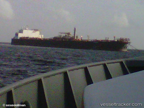
Fso Nabarima
Current StatusWhere is the vessel?
Fso Nabarima is currently in 18 nm N of Pedernales, based on AIS data received about 15h ago.
Latest AIS update:
Current position: 10.24707° N, 62.15058° W (18 nm N of Pedernales)
Average speed (last 7 days): Loading…
Average speed (last 30 days): Loading…
Vessel profile: Fso Nabarima is a Fpso Tanker with dimensions 52m x 258m.
This page combines live AIS, route history, probable destination signals, nearby traffic, and port activity for practical vessel monitoring.
The current position of vessel Fso Nabarima is 10.24707 lat / -62.15058 lng. Updated: 2026-05-21 00:17:37 UTCNearest reference points:
- Near CARENAGE
- Near Carenage
- Near POINT LISAS
Details:
Live Vessel Fso Nabarima Analytics (details, animations, etc.)
Recent AIS points (UTC):
2026-05-20 20:35:31 UTC · 10.24709, -62.15065 · SOG 0 kn · COG -1°2026-05-20 20:35:31 UTC · 10.24709, -62.15065 · SOG 0 kn · COG -1°
2026-05-21 00:17:37 UTC · 10.24707, -62.15058 · SOG 0 kn · COG -1°
2026-05-21 00:17:37 UTC · 10.24707, -62.15058 · SOG 0 kn · COG -1°