 PANCARAN I 5505
Current Status
Where is the vessel?
PANCARAN I 5505 is currently in 25 nm NW of Kolaka, based on AIS data received about 15h ago.
Latest AIS update:
Current position: 3.84667° S, 121.21167° E (25 nm NW of Kolaka)
Average speed (last 7 days): Loading…
Average speed (last 30 days): Loading…
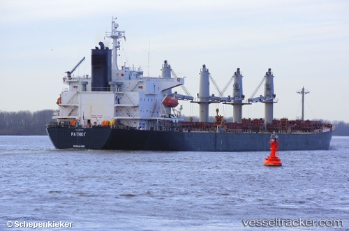
Vessel profile: PANCARAN I 5505 is a Bulk Carrier with dimensions 190m x 33m.
This page combines live AIS, route history, probable destination signals, nearby traffic, and port activity for practical vessel monitoring.
The current position of vessel PANCARAN I 5505 is -3.84667 lat / 121.21167 lng. Updated: 2026-05-19 09:36:07 UTCNearest reference points:
- 13 nm S of KOLAKA
- 27 nm SW of Kolaka
- 45 nm N of KENDARI
Currently sailing under the flag of Indonesia ![]()
PANCARAN I 5505 built in 2004 year
Deadweight:
52454 tDetails:
Live Vessel PANCARAN I 5505 Analytics (details, animations, etc.)
Recent AIS points (UTC):
2026-05-19 06:09:07 UTC · -3.84667, 121.21167 · SOG 0 kn · COG -1°2026-05-19 07:06:06 UTC · -3.84667, 121.21167 · SOG 0 kn · COG -1°
2026-05-19 08:15:04 UTC · -3.84667, 121.21167 · SOG 0 kn · COG -1°
2026-05-19 09:36:07 UTC · -3.84667, 121.21167 · SOG 0 kn · COG -1°