 SB FLEGREA
Current Status
Where is the vessel?
SB FLEGREA is currently in Near Naples, based on AIS data received about 15h ago.
Latest AIS update:
Current position: 40.83686° N, 14.26001° E (Near Naples)
Average speed (last 7 days): Loading…
Average speed (last 30 days): Loading…
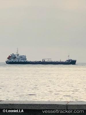
Vessel profile: SB FLEGREA is a Oil/Chemical Tanker with dimensions m x m.
This page combines live AIS, route history, probable destination signals, nearby traffic, and port activity for practical vessel monitoring.
The current position of vessel SB FLEGREA is 40.83686 lat / 14.26001 lng. Updated: 2026-06-04 10:34:16 UTCNearest reference points:
- Near Naples
- Near MERGELLINA
- Near Castellammare di Stabia
Currently sailing under the flag of Italy ![]()
Details:
Live Vessel SB FLEGREA Analytics (details, animations, etc.)
Recent AIS points (UTC):
2026-06-04 07:29:35 UTC · 40.83684, 14.26007 · SOG 0.1 kn · COG 289°2026-06-04 08:06:55 UTC · 40.83692, 14.26013 · SOG 0.2 kn · COG 287°
2026-06-04 10:24:25 UTC · 40.83691, 14.26003 · SOG 0.1 kn · COG 288°
2026-06-04 10:34:16 UTC · 40.83686, 14.26001 · SOG 0 kn · COG 291°