 ATLANTICA SERVER
Current Status
Where is the vessel?
ATLANTICA SERVER is currently in Near Frederikshavn, based on AIS data received about 14h ago.
Latest AIS update:
Current position: 57.40252° N, 10.66180° E (Near Frederikshavn)
Average speed (last 7 days): Loading…
Average speed (last 30 days): Loading…
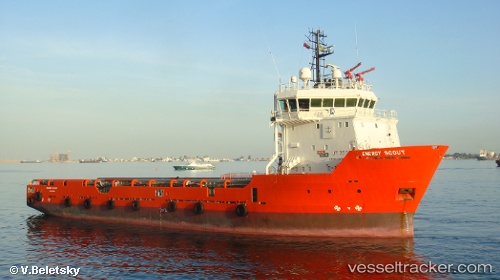
Vessel profile: ATLANTICA SERVER is a Offshore Supply Ship with dimensions m x m.
This page combines live AIS, route history, probable destination signals, nearby traffic, and port activity for practical vessel monitoring.
The current position of vessel ATLANTICA SERVER is 57.40252 lat / 10.66180 lng. Updated: 2026-06-06 10:21:27 UTCNearest reference points:
- Near Frederikshavn
- Near SKAGEN
- 19 nm E of Sæby
Currently sailing under the flag of Bahamas ![]()
Details:
Live Vessel ATLANTICA SERVER Analytics (details, animations, etc.)
Recent AIS points (UTC):
2026-06-06 08:15:48 UTC · 57.40443, 10.66225 · SOG 0 kn · COG 171°2026-06-06 08:15:48 UTC · 57.40443, 10.66225 · SOG 0 kn · COG 171°
2026-06-06 10:06:17 UTC · 57.40244, 10.66176 · SOG 0 kn · COG 180°
2026-06-06 10:21:27 UTC · 57.40252, 10.66180 · SOG 0.1 kn · COG 179°