 vesseltracker.com
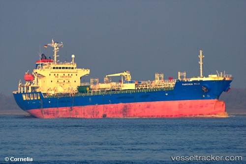
 Lavraki
Current Status
Where is the vessel?
Lavraki is currently in 187 nm SE of Bald Rock, based on AIS data received about 14h ago.
Latest AIS update:
Current position: 41.62500° N, 61.82833° W (187 nm SE of Bald Rock)
Average speed (last 7 days): Loading…
Average speed (last 30 days): Loading…
Vessel profile: Lavraki is a Chemical Oil Products Tanker with dimensions 146m x 24m.
This page combines live AIS, route history, probable destination signals, nearby traffic, and port activity for practical vessel monitoring.
The current position of vessel Lavraki is 41.62500 lat / -61.82833 lng. Updated: 2026-05-18 08:04:23 UTCNearest reference points:
- 116 nm SE of Sheet Harbour
Currently sailing under the flag of Marshall Is ![]()
Lavraki built in 2007 year
Deadweight:
20810 tDetails:
Live Vessel Lavraki Analytics (details, animations, etc.)
Recent AIS points (UTC):
2026-05-18 04:43:22 UTC · 42.24333, -61.53667 · SOG 11 kn · COG -1°2026-05-18 05:40:22 UTC · 42.07333, -61.61500 · SOG 11 kn · COG -1°
2026-05-18 07:43:27 UTC · 41.69534, -61.80234 · SOG 12.4 kn · COG 197°
2026-05-18 08:04:23 UTC · 41.62500, -61.82833 · SOG 12 kn · COG -1°