 vesseltracker.com
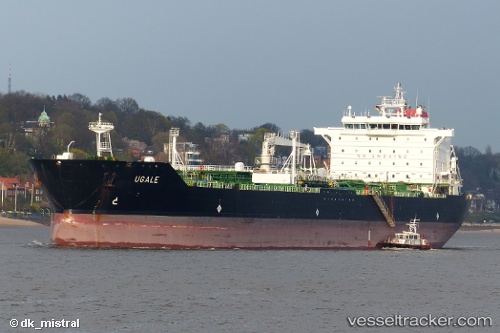
 TURUL
TURUL
Current Status
Where is the vessel?
TURUL is currently in 63 nm SW of Nebelschütz, based on AIS data received about 14h ago.
Latest AIS update:
Current position: 50.37450° N, 15.02415° W (63 nm SW of Nebelschütz)
Average speed (last 7 days): Loading…
Average speed (last 30 days): Loading…
Vessel profile: TURUL is a Oil/Chemical Tanker with dimensions m x m.
This page combines live AIS, route history, probable destination signals, nearby traffic, and port activity for practical vessel monitoring.
The current position of vessel TURUL is 50.37450 lat / -15.02415 lng. Updated: 2026-05-18 04:09:16 UTCCurrently sailing under the flag of Panama ![]()
Details:
Live Vessel TURUL Analytics (details, animations, etc.)
Recent AIS points (UTC):
2026-05-17 23:29:42 UTC · 51.14807, -15.24347 · SOG 11 kn · COG 170°2026-05-18 01:14:49 UTC · 50.84817, -15.16463 · SOG 10.3 kn · COG 174°
2026-05-18 01:14:49 UTC · 50.84817, -15.16463 · SOG 10.3 kn · COG 174°
2026-05-18 04:09:16 UTC · 50.37450, -15.02415 · SOG 9.6 kn · COG 167°