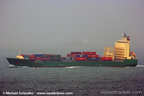
Cape Flores
Current StatusWhere is the vessel?
Cape Flores is currently in 81 nm SE of MOCIMBOA DA PRAIA, based on AIS data received about 15h ago.
Latest AIS update:
Current position: 11.94417° S, 41.58668° E (81 nm SE of MOCIMBOA DA PRAIA)
Average speed (last 7 days): Loading…
Average speed (last 30 days): Loading…
Vessel profile: Cape Flores is a Container Ship with dimensions 24m x 154m.
This page combines live AIS, route history, probable destination signals, nearby traffic, and port activity for practical vessel monitoring.
The current position of vessel Cape Flores is -11.94417 lat / 41.58668 lng. Updated: 2026-05-21 05:58:50 UTCNearest reference points:
- 47 nm NW of Mohéli Apt
- Near Mtwara
- 10 nm N of NACALA PORTO
Details:
Live Vessel Cape Flores Analytics (details, animations, etc.)
Recent AIS points (UTC):
2026-05-21 01:39:59 UTC · -11.23890, 41.58499 · SOG 9.6 kn · COG 176°2026-05-21 03:52:29 UTC · -11.59786, 41.58021 · SOG 9.5 kn · COG 173°
2026-05-21 04:10:31 UTC · -11.64630, 41.57929 · SOG 9.5 kn · COG 173°
2026-05-21 05:58:50 UTC · -11.94417, 41.58668 · SOG 9.7 kn · COG 171°