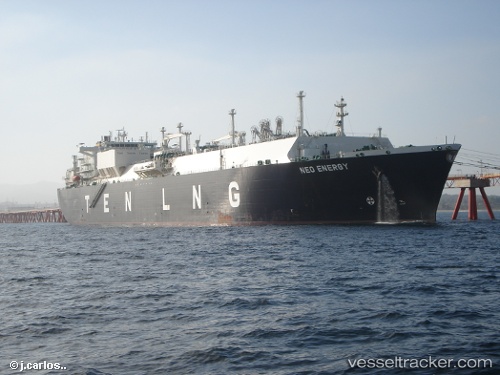
 NOVA ENERGY
Current Status
Where is the vessel?
NOVA ENERGY is currently in 27 nm E of Snohvit, based on AIS data received about 14h ago.
Latest AIS update:
Current position: 71.76111° N, 22.77797° E (27 nm E of Snohvit)
Average speed (last 7 days): Loading…
Average speed (last 30 days): Loading…
Vessel profile: NOVA ENERGY is a Lng Tanker with dimensions m x m.
This page combines live AIS, route history, probable destination signals, nearby traffic, and port activity for practical vessel monitoring.
The current position of vessel NOVA ENERGY is 71.76111 lat / 22.77797 lng. Updated: 2026-05-21 04:36:45 UTCNearest reference points:
- Near SORVAR
- Near Hammerfest
- Near RYPEFJORD
Currently sailing under the flag of Curacao ![]()
Details:
Live Vessel NOVA ENERGY Analytics (details, animations, etc.)
Recent AIS points (UTC):
2026-05-21 01:02:45 UTC · 71.57724, 21.11056 · SOG 8.9 kn · COG 69°2026-05-21 02:11:34 UTC · 71.63881, 21.64121 · SOG 9.6 kn · COG 71°
2026-05-21 03:51:45 UTC · 71.71995, 22.43282 · SOG 9.4 kn · COG 79°
2026-05-21 04:36:45 UTC · 71.76111, 22.77797 · SOG 9.2 kn · COG 62°