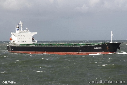
Marinicki
Current StatusWhere is the vessel?
Marinicki is currently in Near WAILINGDING ISLAND, based on AIS data received about 15h ago.
Latest AIS update:
Current position: 21.95690° N, 113.95060° E (Near WAILINGDING ISLAND)
Average speed (last 7 days): Loading…
Average speed (last 30 days): Loading…
Vessel profile: Marinicki is a Bulk Carrier with dimensions 32m x 225m.
This page combines live AIS, route history, probable destination signals, nearby traffic, and port activity for practical vessel monitoring.
The current position of vessel Marinicki is 21.95690 lat / 113.95060 lng. Updated: 2026-05-20 19:13:33 UTCNearest reference points:
- Near WAILINGDING ISLAND
- 15 nm S of WAILINGDING ISLAND
- 14 nm SE of Wanshan Pt
Details:
Live Vessel Marinicki Analytics (details, animations, etc.)
Recent AIS points (UTC):
2026-05-20 15:55:32 UTC · 21.95658, 113.94997 · SOG 0 kn · COG 157°2026-05-20 16:34:33 UTC · 21.95660, 113.95005 · SOG 0 kn · COG 158°
2026-05-20 17:37:38 UTC · 21.95680, 113.95052 · SOG 0 kn · COG 170°
2026-05-20 19:13:33 UTC · 21.95690, 113.95060 · SOG 0 kn · COG 171°