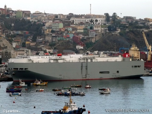
Sierra Nevada Hwy
Current StatusWhere is the vessel?
Sierra Nevada Hwy is currently in Open sea, approx. 444 nm off the nearest listed port, based on AIS data received about 14h ago.
Latest AIS update:
Current position: 34.42809° N, 172.64977° W (Open sea, approx. 444 nm off the nearest listed port)
Average speed (last 7 days): Loading…
Average speed (last 30 days): Loading…
Vessel profile: Sierra Nevada Hwy is a Vehicles Carrier with dimensions 31m x 183m.
This page combines live AIS, route history, probable destination signals, nearby traffic, and port activity for practical vessel monitoring.
The current position of vessel Sierra Nevada Hwy is 34.42809 lat / -172.64977 lng. Updated: 2026-05-19 11:45:14 UTCNearest reference points:
- Open sea, approx. 444 nm off the nearest listed port
- Open sea, approx. 442 nm off the nearest listed port
- Open sea, approx. 453 nm off the nearest listed port
Details:
Live Vessel Sierra Nevada Hwy Analytics (details, animations, etc.)
Recent AIS points (UTC):
2026-05-19 07:44:35 UTC · 34.51424, -171.41319 · SOG 15.3 kn · COG 265°2026-05-19 09:39:06 UTC · 34.47512, -172.00050 · SOG 15.2 kn · COG 265°
2026-05-19 10:25:34 UTC · 34.45320, -172.23727 · SOG 15.3 kn · COG 267°
2026-05-19 11:45:14 UTC · 34.42809, -172.64977 · SOG 16 kn · COG 270°