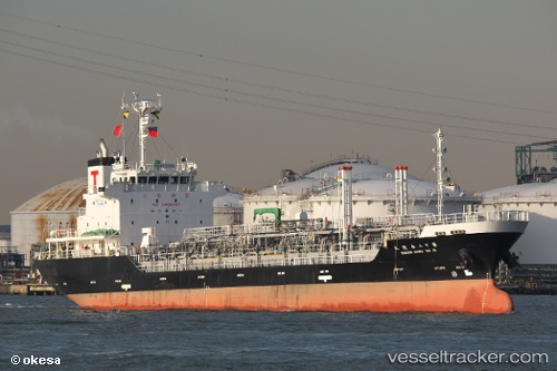
 IRENA XVII
Current Status
Where is the vessel?
IRENA XVII is currently in Near BAUBAU, based on AIS data received about 14h ago.
Latest AIS update:
Current position: 5.45175° S, 122.61776° E (Near BAUBAU)
Average speed (last 7 days): Loading…
Average speed (last 30 days): Loading…
Vessel profile: IRENA XVII is a Tanker with dimensions m x m.
This page combines live AIS, route history, probable destination signals, nearby traffic, and port activity for practical vessel monitoring.
The current position of vessel IRENA XVII is -5.45175 lat / 122.61776 lng. Updated: 2026-05-22 08:22:41 UTCNearest reference points:
- Near BAUBAU
- Near Labuan
- 13 nm S of KOLAKA
Currently sailing under the flag of Indonesia ![]()
Details:
Live Vessel IRENA XVII Analytics (details, animations, etc.)
Recent AIS points (UTC):
2026-05-22 05:03:14 UTC · -5.45500, 122.62402 · SOG 0.1 kn · COG -1°2026-05-22 06:24:15 UTC · -5.45369, 122.62423 · SOG 0.2 kn · COG -1°
2026-05-22 07:21:16 UTC · -5.45500, 122.62418 · SOG 0 kn · COG -1°
2026-05-22 08:22:41 UTC · -5.45175, 122.61776 · SOG 7.7 kn · COG 273°