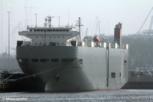
Eastern Highway
Current StatusWhere is the vessel?
Eastern Highway is currently in Near Fremantle, based on AIS data received about 15h ago.
Latest AIS update:
Current position: 32.01678° S, 115.67458° E (Near Fremantle)
Average speed (last 7 days): Loading…
Average speed (last 30 days): Loading…
Vessel profile: Eastern Highway is a Vehicles Carrier with dimensions 28m x 188m.
This page combines live AIS, route history, probable destination signals, nearby traffic, and port activity for practical vessel monitoring.
The current position of vessel Eastern Highway is -32.01678 lat / 115.67458 lng. Updated: 2026-05-21 13:48:40 UTCNearest reference points:
- Near ROTTNEST ISLAND
- Near Fremantle
- Near Kwinana
Details:
Live Vessel Eastern Highway Analytics (details, animations, etc.)
Recent AIS points (UTC):
2026-05-21 10:12:40 UTC · -32.01687, 115.67384 · SOG 0.5 kn · COG 174°2026-05-21 12:06:41 UTC · -32.01674, 115.67464 · SOG 0.1 kn · COG 164°
2026-05-21 13:30:40 UTC · -32.01653, 115.67428 · SOG 0.8 kn · COG 198°
2026-05-21 13:48:40 UTC · -32.01678, 115.67458 · SOG 0.2 kn · COG 165°