Western Highway
Current StatusWhere is the vessel?
Western Highway is currently in 53 nm W of Sangwangdeungdo, based on AIS data received about 14h ago.
Latest AIS update:
Current position: 35.61167° N, 125.03792° E (53 nm W of Sangwangdeungdo)
Average speed (last 7 days): Loading…
Average speed (last 30 days): Loading…
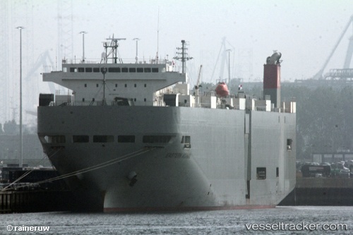
Vessel profile: Western Highway is a Vehicles Carrier with dimensions 28m x 188m.
This page combines live AIS, route history, probable destination signals, nearby traffic, and port activity for practical vessel monitoring.
The current position of vessel Western Highway is 35.61167 lat / 125.03792 lng. Updated: 2026-05-21 15:00:42 UTCNearest reference points:
- 54 nm W of Taean-gun
- 19 nm NW of Sangwangdeungdo
- 93 nm SE of SHIDAO
Details:
Live Vessel Western Highway Analytics (details, animations, etc.)
Recent AIS points (UTC):
2026-05-21 15:00:42 UTC · 35.61167, 125.03792 · SOG 3.7 kn · COG 344°2026-05-21 15:00:42 UTC · 35.61167, 125.03792 · SOG 3.7 kn · COG 344°
2026-05-21 15:00:42 UTC · 35.61167, 125.03792 · SOG 3.7 kn · COG 344°
2026-05-21 15:00:42 UTC · 35.61167, 125.03792 · SOG 3.7 kn · COG 344°