 VOYAGER
Current Status
Where is the vessel?
VOYAGER is currently in 74 nm N of Ulleung-gun, based on AIS data received about 14h ago.
Latest AIS update:
Current position: 38.71583° N, 131.01845° E (74 nm N of Ulleung-gun)
Average speed (last 7 days): Loading…
Average speed (last 30 days): Loading…
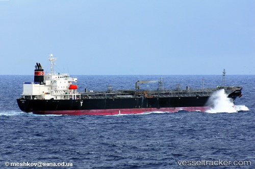
Vessel profile: VOYAGER is a Oil/Chemical Tanker with dimensions m x m.
This page combines live AIS, route history, probable destination signals, nearby traffic, and port activity for practical vessel monitoring.
The current position of vessel VOYAGER is 38.71583 lat / 131.01845 lng. Updated: 2026-05-19 01:59:44 UTCNearest reference points:
- 96 nm N of Ulleung-gun
- 33 nm NE of Ulleung-gun
- 94 nm N of Dokdo
Currently sailing under the flag of Liberia ![]()
Details:
Live Vessel VOYAGER Analytics (details, animations, etc.)
Recent AIS points (UTC):
2026-05-18 22:44:05 UTC · 39.33694, 131.37424 · SOG 12.6 kn · COG 208°2026-05-18 23:22:49 UTC · 39.21726, 131.30721 · SOG 11.8 kn · COG 210°
2026-05-19 01:45:05 UTC · 38.76641, 131.04152 · SOG 13.2 kn · COG 202°
2026-05-19 01:59:44 UTC · 38.71583, 131.01845 · SOG 13.2 kn · COG 203°