 vesseltracker.com
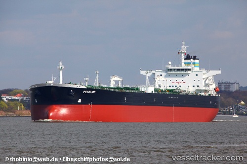
 Penelop
Current Status
Where is the vessel?
Penelop is currently in 35 nm NW of Belmullet, based on AIS data received about 14h ago.
Latest AIS update:
Current position: 54.69500° N, 10.56667° W (35 nm NW of Belmullet)
Average speed (last 7 days): Loading…
Average speed (last 30 days): Loading…
Vessel profile: Penelop is a Crude Oil Tanker with dimensions 255m x 44m.
This page combines live AIS, route history, probable destination signals, nearby traffic, and port activity for practical vessel monitoring.
The current position of vessel Penelop is 54.69500 lat / -10.56667 lng. Updated: 2026-05-18 04:10:47 UTCNearest reference points:
- 10 nm NE of Belmullet
- Near Tarbert Island
Currently sailing under the flag of Bahamas ![]()
Penelop built in 2006 year
Deadweight:
115091 tDetails:
Live Vessel Penelop Analytics (details, animations, etc.)
Recent AIS points (UTC):
2026-05-17 23:29:59 UTC · 55.41618, -10.22542 · SOG 9.7 kn · COG 197°2026-05-18 01:29:59 UTC · 55.10762, -10.37653 · SOG 9.9 kn · COG 197°
2026-05-18 01:31:59 UTC · 55.10243, -10.37919 · SOG 9.8 kn · COG 198°
2026-05-18 04:10:47 UTC · 54.69500, -10.56667 · SOG 9 kn · COG -1°