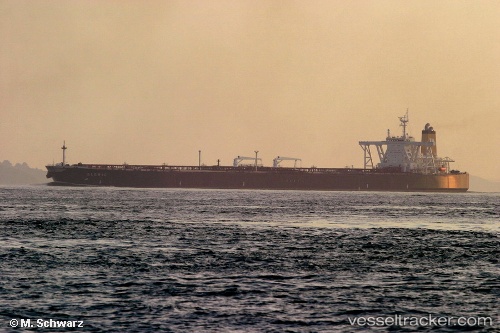
 TEJAS
TEJAS
Current Status
Where is the vessel?
TEJAS is currently in 89 nm NE of Nangang, based on AIS data received about 14h ago.
Latest AIS update:
Current position: 26.26227° N, 122.98570° E (89 nm NE of Nangang)
Average speed (last 7 days): Loading…
Average speed (last 30 days): Loading…
Vessel profile: TEJAS is a Tanker with dimensions m x m.
This page combines live AIS, route history, probable destination signals, nearby traffic, and port activity for practical vessel monitoring.
The current position of vessel TEJAS is 26.26227 lat / 122.98570 lng. Updated: 2026-05-22 05:00:39 UTCNearest reference points:
- 76 nm NE of Nangang
- 120 nm NE of Nangang
- 97 nm SE of Wenling Longmen Port
Currently sailing under the flag of Panama ![]()
Details:
Live Vessel TEJAS Analytics (details, animations, etc.)
Recent AIS points (UTC):
2026-05-22 01:16:18 UTC · 26.87818, 123.18290 · SOG 10.5 kn · COG 194°2026-05-22 01:48:59 UTC · 26.78447, 123.15712 · SOG 10.6 kn · COG 201°
2026-05-22 03:18:08 UTC · 26.53740, 123.06368 · SOG 10.8 kn · COG 196°
2026-05-22 05:00:39 UTC · 26.26227, 122.98570 · SOG 9.5 kn · COG -1°