 vesseltracker.com
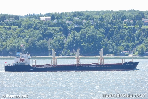
 HOANG ANH 02
Current Status
Where is the vessel?
HOANG ANH 02 is currently in 357 nm SW of Veraval, based on AIS data received about 14h ago.
Latest AIS update:
Current position: 16.33282° N, 66.32558° E (357 nm SW of Veraval)
Average speed (last 7 days): Loading…
Average speed (last 30 days): Loading…
Vessel profile: HOANG ANH 02 is a Bulk Carrier with dimensions m x m.
This page combines live AIS, route history, probable destination signals, nearby traffic, and port activity for practical vessel monitoring.
The current position of vessel HOANG ANH 02 is 16.33282 lat / 66.32558 lng. Updated: 2026-05-18 07:37:22 UTCNearest reference points:
- Open sea, approx. 401 nm off the nearest listed port
- Open sea, approx. 400 nm off the nearest listed port
- Open sea, approx. 404 nm off the nearest listed port
Currently sailing under the flag of Panama ![]()
Details:
Live Vessel HOANG ANH 02 Analytics (details, animations, etc.)
Recent AIS points (UTC):
2026-05-17 23:29:25 UTC · 17.68125, 66.41943 · SOG 10.1 kn · COG 179°2026-05-18 04:32:08 UTC · 16.83708, 66.37499 · SOG 9.8 kn · COG 182°
2026-05-18 07:37:22 UTC · 16.33282, 66.32558 · SOG 10.1 kn · COG 184°
2026-05-18 07:37:22 UTC · 16.33282, 66.32558 · SOG 10.1 kn · COG 184°