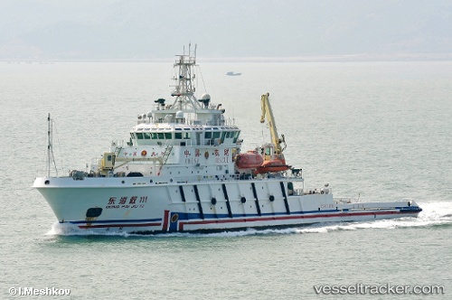
 DONG HAI JIU 111
Current Status
Where is the vessel?
DONG HAI JIU 111 is currently in 27 nm E of CHENJIAGANG, based on AIS data received about 14h ago.
Latest AIS update:
Current position: 34.43409° N, 120.33446° E (27 nm E of CHENJIAGANG)
Average speed (last 7 days): Loading…
Average speed (last 30 days): Loading…
Vessel profile: DONG HAI JIU 111 is a Salvage/Rescue Vessel with dimensions m x m.
This page combines live AIS, route history, probable destination signals, nearby traffic, and port activity for practical vessel monitoring.
The current position of vessel DONG HAI JIU 111 is 34.43409 lat / 120.33446 lng. Updated: 2026-05-19 11:16:00 UTCNearest reference points:
- 25 nm E of CHENJIAGANG
- 37 nm E of CHENJIAGANG
- 41 nm NE of CHENJIAGANG
Currently sailing under the flag of China ![]()
Details:
Live Vessel DONG HAI JIU 111 Analytics (details, animations, etc.)
Recent AIS points (UTC):
2026-05-19 07:52:29 UTC · 34.43581, 120.33337 · SOG 0 kn · COG 139°2026-05-19 08:52:31 UTC · 34.43577, 120.33329 · SOG 0 kn · COG 142°
2026-05-19 11:01:00 UTC · 34.43398, 120.33411 · SOG 0.1 kn · COG 4°
2026-05-19 11:16:00 UTC · 34.43409, 120.33446 · SOG 0.1 kn · COG 353°