 DOLUNAY
Current Status
Where is the vessel?
DOLUNAY is currently in 30 nm S of Selsey, based on AIS data received about 14h ago.
Latest AIS update:
Current position: 50.26321° N, 0.54800° W (30 nm S of Selsey)
Average speed (last 7 days): Loading…
Average speed (last 30 days): Loading…
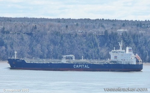
Vessel profile: DOLUNAY is a Oil/Chemical Tanker with dimensions m x m.
This page combines live AIS, route history, probable destination signals, nearby traffic, and port activity for practical vessel monitoring.
The current position of vessel DOLUNAY is 50.26321 lat / -0.54800 lng. Updated: 2026-05-21 00:16:06 UTCNearest reference points:
- 23 nm S of Ferring
- 15 nm S of Selsey
- 27 nm S of Seaford
Currently sailing under the flag of Palau ![]()
Details:
Live Vessel DOLUNAY Analytics (details, animations, etc.)
Recent AIS points (UTC):
2026-05-20 17:35:13 UTC · 49.73358, -3.10864 · SOG 12.9 kn · COG 60°2026-05-20 22:08:30 UTC · 50.09467, -1.45067 · SOG 17.2 kn · COG 72°
2026-05-20 22:15:02 UTC · 50.10333, -1.40437 · SOG 17.2 kn · COG 72°
2026-05-21 00:16:06 UTC · 50.26321, -0.54800 · SOG 16.3 kn · COG 74°