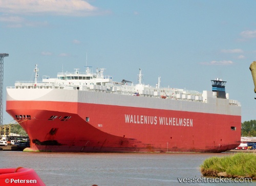
Tarifa
Current StatusWhere is the vessel?
Tarifa is currently in 95 nm N of Sinnamary, based on AIS data received about 15h ago.
Latest AIS update:
Current position: 6.89923° N, 52.50899° W (95 nm N of Sinnamary)
Average speed (last 7 days): Loading…
Average speed (last 30 days): Loading…
Vessel profile: Tarifa is a Vehicles Carrier with dimensions 30m x 200m.
This page combines live AIS, route history, probable destination signals, nearby traffic, and port activity for practical vessel monitoring.
The current position of vessel Tarifa is 6.89923 lat / -52.50899 lng. Updated: 2026-05-20 01:41:20 UTCDetails:
Live Vessel Tarifa Analytics (details, animations, etc.)
Recent AIS points (UTC):
2026-05-19 22:27:52 UTC · 7.25167, -53.08167 · SOG 12 kn · COG -1°2026-05-19 23:28:13 UTC · 7.14173, -52.90073 · SOG 12.9 kn · COG 122°
2026-05-20 01:37:23 UTC · 6.90687, -52.52052 · SOG 12.5 kn · COG 124°
2026-05-20 01:41:20 UTC · 6.89923, -52.50899 · SOG 12.3 kn · COG 124°