 vesseltracker.com
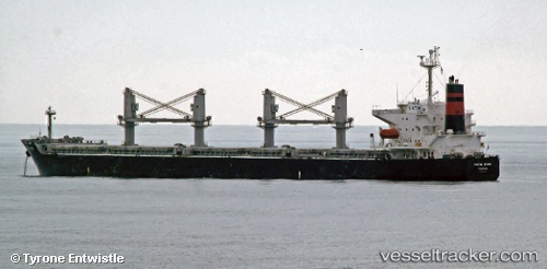
 VIET THUAN 56 05
Current Status
Where is the vessel?
VIET THUAN 56 05 is currently in 40 nm NE of Tan Cang Qui Nhon, based on AIS data received about 15h ago.
Latest AIS update:
Current position: 14.15094° N, 110.39862° E (40 nm NE of Tan Cang Qui Nhon)
Average speed (last 7 days): Loading…
Average speed (last 30 days): Loading…
Vessel profile: VIET THUAN 56 05 is a Bulk Carrier with dimensions m x m.
This page combines live AIS, route history, probable destination signals, nearby traffic, and port activity for practical vessel monitoring.
The current position of vessel VIET THUAN 56 05 is 14.15094 lat / 110.39862 lng. Updated: 2026-05-18 04:13:56 UTCNearest reference points:
- 29 nm NE of Vung Ro
- 17 nm NE of Bong Son
- Near Bong Son
Currently sailing under the flag of Panama ![]()
Details:
Live Vessel VIET THUAN 56 05 Analytics (details, animations, etc.)
Recent AIS points (UTC):
2026-05-18 01:25:17 UTC · 14.62667, 110.54333 · SOG 10 kn · COG -1°2026-05-18 01:46:23 UTC · 14.56833, 110.52333 · SOG 10 kn · COG -1°
2026-05-18 02:55:17 UTC · 14.37833, 110.46167 · SOG 10 kn · COG -1°
2026-05-18 04:13:56 UTC · 14.15094, 110.39862 · SOG 11 kn · COG 190°