 vesseltracker.com
 NISI
NISI
Current Status
Where is the vessel?
NISI is currently in Near Montego Bay, based on AIS data received about 14h ago.
Latest AIS update:
Current position: 18.46138° N, 77.93669° W (Near Montego Bay)
Average speed (last 7 days): Loading…
Average speed (last 30 days): Loading…
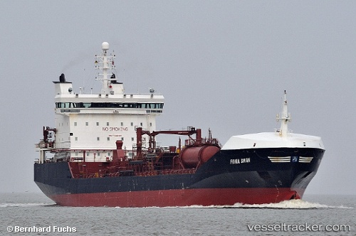
Vessel profile: NISI is a Oil/Chemical Tanker with dimensions m x m.
This page combines live AIS, route history, probable destination signals, nearby traffic, and port activity for practical vessel monitoring.
The current position of vessel NISI is 18.46138 lat / -77.93669 lng. Updated: 2026-05-18 06:04:46 UTCNearest reference points:
- 16 nm SE of Ceiba Hueca
Currently sailing under the flag of Cyprus ![]()
Details:
Live Vessel NISI Analytics (details, animations, etc.)
Recent AIS points (UTC):
2026-05-18 02:16:46 UTC · 18.46139, -77.93669 · SOG 0 kn · COG 21°2026-05-18 04:19:46 UTC · 18.46138, -77.93671 · SOG 0 kn · COG 22°
2026-05-18 04:37:46 UTC · 18.46138, -77.93669 · SOG 0 kn · COG 22°
2026-05-18 06:04:46 UTC · 18.46138, -77.93669 · SOG 0 kn · COG 22°