 AS CLAUDIA
Current Status
Where is the vessel?
AS CLAUDIA is currently in Near Wangerooge, based on AIS data received about 14h ago.
Latest AIS update:
Current position: 53.85617° N, 7.96256° E (Near Wangerooge)
Average speed (last 7 days): Loading…
Average speed (last 30 days): Loading…
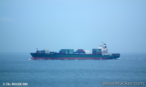
Vessel profile: AS CLAUDIA is a Container Ship with dimensions m x m.
This page combines live AIS, route history, probable destination signals, nearby traffic, and port activity for practical vessel monitoring.
The current position of vessel AS CLAUDIA is 53.85617 lat / 7.96256 lng. Updated: 2026-06-02 02:28:11 UTCNearest reference points:
- Near Wangerooge
- Near Horumersiel
- 10 nm E of Wangerooge
Currently sailing under the flag of Liberia ![]()
Details:
Live Vessel AS CLAUDIA Analytics (details, animations, etc.)
Recent AIS points (UTC):
2026-06-01 22:17:41 UTC · 53.92167, 7.84758 · SOG 0 kn · COG 251°2026-06-01 23:38:39 UTC · 53.92242, 7.84736 · SOG 0.1 kn · COG 228°
2026-06-02 02:07:52 UTC · 53.86921, 7.84713 · SOG 10.2 kn · COG 104°
2026-06-02 02:28:11 UTC · 53.85617, 7.96256 · SOG 12.8 kn · COG 102°