 TANGER A
Current Status
Where is the vessel?
TANGER A is currently in 12 nm NW of Mohammedia, based on AIS data received about 15h ago.
Latest AIS update:
Current position: 33.85725° N, 7.55624° W (12 nm NW of Mohammedia)
Average speed (last 7 days): Loading…
Average speed (last 30 days): Loading…
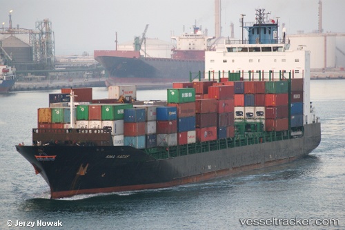
Vessel profile: TANGER A is a Container Ship with dimensions m x m.
This page combines live AIS, route history, probable destination signals, nearby traffic, and port activity for practical vessel monitoring.
The current position of vessel TANGER A is 33.85725 lat / -7.55624 lng. Updated: 2026-05-22 05:52:05 UTCNearest reference points:
- Near Mohammedia
- 54 nm N of El Jadida
- Near Jorf Lasfar
Currently sailing under the flag of Morocco ![]()
Details:
Live Vessel TANGER A Analytics (details, animations, etc.)
Recent AIS points (UTC):
2026-05-22 02:34:08 UTC · 33.60597, -7.59696 · SOG 0 kn · COG 331°2026-05-22 03:58:05 UTC · 33.60598, -7.59692 · SOG 0 kn · COG 330°
2026-05-22 04:27:14 UTC · 33.62058, -7.58174 · SOG 9.9 kn · COG 62°
2026-05-22 05:52:05 UTC · 33.85725, -7.55624 · SOG 10.3 kn · COG 0°