 SKIPPER TIDE
Current Status
Where is the vessel?
SKIPPER TIDE is currently in 49 nm NE of Foinaven, based on AIS data received about 15h ago.
Latest AIS update:
Current position: 61.07500° N, 3.68833° W (49 nm NE of Foinaven)
Average speed (last 7 days): Loading…
Average speed (last 30 days): Loading…
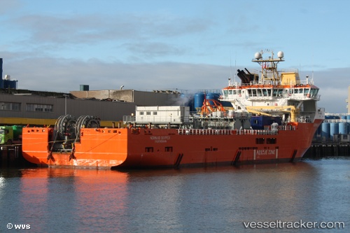
Vessel profile: SKIPPER TIDE is a Multi Purpose Offshore Vessel with dimensions m x m.
This page combines live AIS, route history, probable destination signals, nearby traffic, and port activity for practical vessel monitoring.
The current position of vessel SKIPPER TIDE is 61.07500 lat / -3.68833 lng. Updated: 2026-05-22 01:15:24 UTCNearest reference points:
- 36 nm NW of Ham Voe, Foula
- 32 nm NW of Eshaness
- Near Tingwall
Currently sailing under the flag of United Kingdom ![]()
Details:
Live Vessel SKIPPER TIDE Analytics (details, animations, etc.)
Recent AIS points (UTC):
2026-05-21 19:57:58 UTC · 61.05837, -3.70214 · SOG 0.2 kn · COG 220°2026-05-21 22:07:19 UTC · 61.06938, -3.68628 · SOG 3.2 kn · COG 41°
2026-05-21 22:25:16 UTC · 61.07227, -3.68357 · SOG 0.2 kn · COG 224°
2026-05-22 01:15:24 UTC · 61.07500, -3.68833 · SOG 0 kn · COG -1°