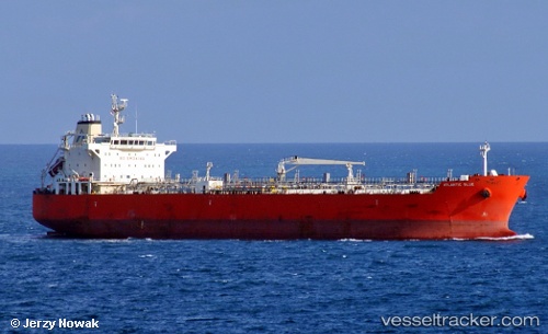
 GRIF
GRIF
Current Status
Where is the vessel?
GRIF is currently in 17 nm SW of Kefalos Ko, based on AIS data received about 15h ago.
Latest AIS update:
Current position: 36.48800° N, 26.79955° E (17 nm SW of Kefalos Ko)
Average speed (last 7 days): Loading…
Average speed (last 30 days): Loading…
Vessel profile: GRIF is a Oil/Chemical Tanker with dimensions m x m.
This page combines live AIS, route history, probable destination signals, nearby traffic, and port activity for practical vessel monitoring.
The current position of vessel GRIF is 36.48800 lat / 26.79955 lng. Updated: 2026-05-21 11:25:30 UTCNearest reference points:
- 20 nm S of Astypálaia
- Near KALYMNOS
- 11 nm E of GYALI
Currently sailing under the flag of Cameroon ![]()
Details:
Live Vessel GRIF Analytics (details, animations, etc.)
Recent AIS points (UTC):
2026-05-21 08:14:19 UTC · 36.00049, 27.29624 · SOG 11.8 kn · COG 321°2026-05-21 09:56:50 UTC · 36.26443, 27.03025 · SOG 11.7 kn · COG 321°
2026-05-21 10:50:09 UTC · 36.39849, 26.88981 · SOG 11.9 kn · COG 321°
2026-05-21 11:25:30 UTC · 36.48800, 26.79955 · SOG 11.6 kn · COG 324°