 SEA BAZOU 2
Current Status
Where is the vessel?
SEA BAZOU 2 is currently in 15 nm SW of Douala, based on AIS data received about 16h ago.
Latest AIS update:
Current position: 3.88277° N, 9.50107° E (15 nm SW of Douala)
Average speed (last 7 days): Loading…
Average speed (last 30 days): Loading…
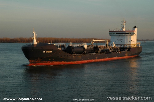
Vessel profile: SEA BAZOU 2 is a Chemical/Oil Products Tanker with dimensions 148m x 148m.
This page combines live AIS, route history, probable destination signals, nearby traffic, and port activity for practical vessel monitoring.
The current position of vessel SEA BAZOU 2 is 3.88277 lat / 9.50107 lng. Updated: 2026-05-18 20:41:05 UTCNearest reference points:
- Near Victoria
- Near Moudi Terminal
- Near Calabar
Currently sailing under the flag of Marshall Islands ![]()
SEA BAZOU 2 built in 2006 year
Deadweight:
15551 tDetails:
Live Vessel SEA BAZOU 2 Analytics (details, animations, etc.)
Recent AIS points (UTC):
2026-05-18 17:32:02 UTC · 3.88574, 9.50455 · SOG 0 kn · COG 250°2026-05-18 18:35:05 UTC · 3.88442, 9.50450 · SOG 0.3 kn · COG 288°
2026-05-18 18:35:05 UTC · 3.88442, 9.50450 · SOG 0.3 kn · COG 288°
2026-05-18 20:41:05 UTC · 3.88277, 9.50107 · SOG 0.1 kn · COG 27°