 vesseltracker.com
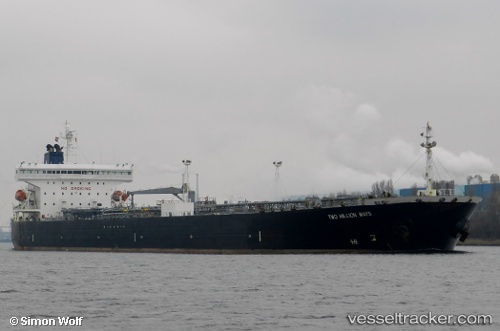
 SANMAR SUPARNA
Current Status
Where is the vessel?
SANMAR SUPARNA is currently in 19 nm NE of Mina Saud, based on AIS data received about 14h ago.
Latest AIS update:
Current position: 28.90750° N, 48.71108° E (19 nm NE of Mina Saud)
Average speed (last 7 days): Loading…
Average speed (last 30 days): Loading…
Vessel profile: SANMAR SUPARNA is a Crude Oil Tanker with dimensions m x m.
This page combines live AIS, route history, probable destination signals, nearby traffic, and port activity for practical vessel monitoring.
The current position of vessel SANMAR SUPARNA is 28.90750 lat / 48.71108 lng. Updated: 2026-05-18 07:13:03 UTCNearest reference points:
- 25 nm W of Soroosh (Cyrus) Terminal
- Near Mina Al Zour
- 19 nm SW of Soroosh (Cyrus) Terminal
Currently sailing under the flag of India ![]()
Details:
Live Vessel SANMAR SUPARNA Analytics (details, animations, etc.)
Recent AIS points (UTC):
2026-05-18 04:05:36 UTC · 28.90088, 49.38830 · SOG 9 kn · COG 289°2026-05-18 05:02:37 UTC · 28.90127, 49.23638 · SOG 8.7 kn · COG 245°
2026-05-18 06:00:56 UTC · 28.89470, 49.01800 · SOG 13.4 kn · COG 282°
2026-05-18 07:13:03 UTC · 28.90750, 48.71108 · SOG 13.4 kn · COG 282°