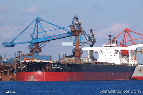
 OWARI MARU
Current Status
Where is the vessel?
OWARI MARU is currently in 393 nm NE of Levelwood, based on AIS data received about 14h ago.
Latest AIS update:
Current position: 11.79958° S, 0.10132° E (393 nm NE of Levelwood)
Average speed (last 7 days): Loading…
Average speed (last 30 days): Loading…
Vessel profile: OWARI MARU is a Ore Carrier with dimensions m x m.
This page combines live AIS, route history, probable destination signals, nearby traffic, and port activity for practical vessel monitoring.
The current position of vessel OWARI MARU is -11.79958 lat / 0.10132 lng. Updated: 2026-05-21 13:33:41 UTCNearest reference points:
- Open sea, approx. 401 nm off the nearest listed port
- Open sea, approx. 400 nm off the nearest listed port
- Open sea, approx. 404 nm off the nearest listed port
Currently sailing under the flag of Liberia ![]()
Details:
Live Vessel OWARI MARU Analytics (details, animations, etc.)
Recent AIS points (UTC):
2026-05-21 09:43:40 UTC · -12.32382, 0.50914 · SOG 10.2 kn · COG 330°2026-05-21 11:02:43 UTC · -12.14690, 0.36439 · SOG 10.5 kn · COG 323°
2026-05-21 11:31:00 UTC · -12.08458, 0.31061 · SOG 10.3 kn · COG 323°
2026-05-21 13:33:41 UTC · -11.79958, 0.10132 · SOG 10.3 kn · COG 329°