 Grimstad
Current Status
Where is the vessel?
Grimstad is currently in 68 nm NW of CEDEIRA, based on AIS data received about 15h ago.
Latest AIS update:
Current position: 44.59333° N, 8.95500° W (68 nm NW of CEDEIRA)
Average speed (last 7 days): Loading…
Average speed (last 30 days): Loading…
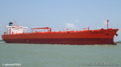
Vessel profile: Grimstad is a Crude Oil Tanker with dimensions 240m x 42m.
This page combines live AIS, route history, probable destination signals, nearby traffic, and port activity for practical vessel monitoring.
The current position of vessel Grimstad is 44.59333 lat / -8.95500 lng. Updated: 2026-05-19 07:49:50 UTCNearest reference points:
- 30 nm NW of Meiras-Valdoviño
- 15 nm NW of CEDEIRA
- 13 nm NE of Villanueva de Lorenzana
Currently sailing under the flag of Bahamas ![]()
Grimstad built in 2007 year
Deadweight:
105786 tDetails:
Live Vessel Grimstad Analytics (details, animations, etc.)
Recent AIS points (UTC):
2026-05-19 04:52:48 UTC · 44.06167, -9.34167 · SOG 11 kn · COG -1°2026-05-19 05:43:47 UTC · 44.21500, -9.24167 · SOG 12 kn · COG -1°
2026-05-19 07:24:49 UTC · 44.51919, -9.01430 · SOG 12.1 kn · COG -1°
2026-05-19 07:49:50 UTC · 44.59333, -8.95500 · SOG 12 kn · COG -1°