 SELVA
SELVA
Current Status
Where is the vessel?
SELVA is currently in 20 nm NE of Dumyat (Damietta), based on AIS data received about 14h ago.
Latest AIS update:
Current position: 31.57147° N, 32.15735° E (20 nm NE of Dumyat (Damietta))
Average speed (last 7 days): Loading…
Average speed (last 30 days): Loading…
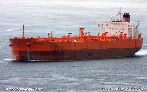
Vessel profile: SELVA is a Crude Oil Tanker with dimensions m x m.
This page combines live AIS, route history, probable destination signals, nearby traffic, and port activity for practical vessel monitoring.
The current position of vessel SELVA is 31.57147 lat / 32.15735 lng. Updated: 2026-05-22 04:12:20 UTCNearest reference points:
- 21 nm N of Port Said
- 15 nm N of Port Said
- 16 nm N of Port Said
Currently sailing under the flag of Oman ![]()
Details:
Live Vessel SELVA Analytics (details, animations, etc.)
Recent AIS points (UTC):
2026-05-22 01:07:01 UTC · 31.84769, 31.77632 · SOG 6.9 kn · COG 124°2026-05-22 02:02:00 UTC · 31.79051, 31.88432 · SOG 7.1 kn · COG 125°
2026-05-22 03:27:31 UTC · 31.66846, 32.04808 · SOG 10.3 kn · COG 145°
2026-05-22 04:12:20 UTC · 31.57147, 32.15735 · SOG 11 kn · COG 134°