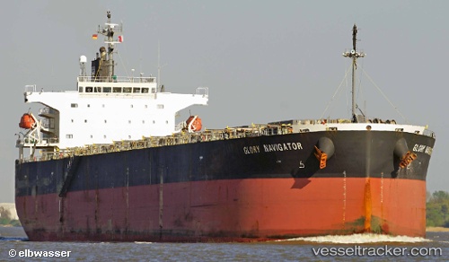
Glory Navigator
Current StatusWhere is the vessel?
Glory Navigator is currently in 63 nm W of Terempa, based on AIS data received about 14h ago.
Latest AIS update:
Current position: 2.85403° N, 105.22737° E (63 nm W of Terempa)
Average speed (last 7 days): Loading…
Average speed (last 30 days): Loading…
Vessel profile: Glory Navigator is a Bulk Carrier with dimensions 32m x 225m.
This page combines live AIS, route history, probable destination signals, nearby traffic, and port activity for practical vessel monitoring.
The current position of vessel Glory Navigator is 2.85403 lat / 105.22737 lng. Updated: 2026-05-19 07:26:29 UTCNearest reference points:
- 80 nm SW of Terempa
- 64 nm NE of PENGERANG
- 39 nm SE of Belida Terminal
Details:
Live Vessel Glory Navigator Analytics (details, animations, etc.)
Recent AIS points (UTC):
2026-05-19 04:06:38 UTC · 2.34355, 105.01570 · SOG 10 kn · COG -1°2026-05-19 05:31:46 UTC · 2.56402, 105.10532 · SOG 9.8 kn · COG -1°
2026-05-19 07:21:56 UTC · 2.84205, 105.22093 · SOG 9.3 kn · COG -1°
2026-05-19 07:26:29 UTC · 2.85403, 105.22737 · SOG 9.6 kn · COG 21°