 Ym Utility
Current Status
Where is the vessel?
Ym Utility is currently in 75 nm S of Trebnje, based on AIS data received about 14h ago.
Latest AIS update:
Current position: 44.66327° N, 150.73775° E (75 nm S of Trebnje)
Average speed (last 7 days): Loading…
Average speed (last 30 days): Loading…
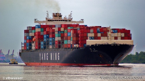
Vessel profile: Ym Utility is a Container Ship with dimensions 333m x 42m.
This page combines live AIS, route history, probable destination signals, nearby traffic, and port activity for practical vessel monitoring.
The current position of vessel Ym Utility is 44.66327 lat / 150.73775 lng. Updated: 2026-05-22 07:46:34 UTCCurrently sailing under the flag of Liberia ![]()
Ym Utility built in 2009 year
Deadweight:
103614 tDetails:
Live Vessel Ym Utility Analytics (details, animations, etc.)
Recent AIS points (UTC):
2026-05-22 04:04:46 UTC · 44.27125, 149.58650 · SOG 14.7 kn · COG 64°2026-05-22 06:00:15 UTC · 44.47455, 150.18004 · SOG 14.8 kn · COG 65°
2026-05-22 07:25:35 UTC · 44.62365, 150.62885 · SOG 14.7 kn · COG 63°
2026-05-22 07:46:34 UTC · 44.66327, 150.73775 · SOG 15.1 kn · COG 64°