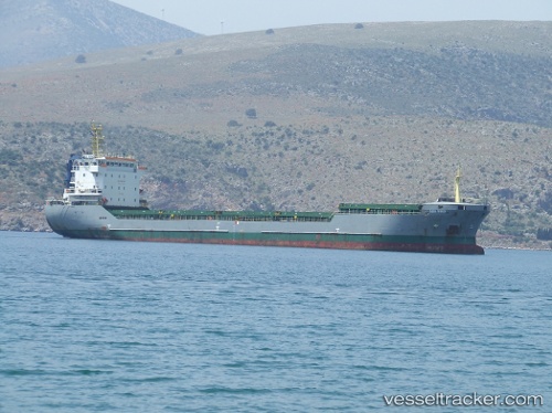
 AK HAMZA
Current Status
Where is the vessel?
AK HAMZA is currently in 15 nm E of VINAROS, based on AIS data received about 15h ago.
Latest AIS update:
Current position: 40.38661° N, 0.79894° E (15 nm E of VINAROS)
Average speed (last 7 days): Loading…
Average speed (last 30 days): Loading…
Vessel profile: AK HAMZA is a General Cargo with dimensions m x m.
This page combines live AIS, route history, probable destination signals, nearby traffic, and port activity for practical vessel monitoring.
The current position of vessel AK HAMZA is 40.38661 lat / 0.79894 lng. Updated: 2026-05-23 01:58:16 UTCNearest reference points:
- Near San Carlos de la Rápita
- 43 nm SE of PENISCOLA
- Near OROPESA DEL MAR
Currently sailing under the flag of Barbados ![]()
Details:
Live Vessel AK HAMZA Analytics (details, animations, etc.)
Recent AIS points (UTC):
2026-05-22 23:08:04 UTC · 40.82480, 1.09555 · SOG 10.6 kn · COG 199°2026-05-22 23:26:05 UTC · 40.77597, 1.07001 · SOG 10.4 kn · COG 199°
2026-05-23 01:57:05 UTC · 40.38953, 0.80149 · SOG 10.8 kn · COG 212°
2026-05-23 01:58:16 UTC · 40.38661, 0.79894 · SOG 11 kn · COG 212°