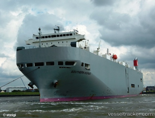
Southern Highway
Current StatusWhere is the vessel?
Southern Highway is currently in 19 nm NE of Gold Coast, based on AIS data received about 15h ago.
Latest AIS update:
Current position: 27.82647° S, 153.72470° E (19 nm NE of Gold Coast)
Average speed (last 7 days): Loading…
Average speed (last 30 days): Loading…
Vessel profile: Southern Highway is a Vehicles Carrier with dimensions 28m x 188m.
This page combines live AIS, route history, probable destination signals, nearby traffic, and port activity for practical vessel monitoring.
The current position of vessel Southern Highway is -27.82647 lat / 153.72470 lng. Updated: 2026-05-19 16:26:57 UTCNearest reference points:
- Near Biggera Waters
- Near Gold Coast
- Near Labrador
Details:
Live Vessel Southern Highway Analytics (details, animations, etc.)
Recent AIS points (UTC):
2026-05-19 13:51:09 UTC · -27.07817, 153.67143 · SOG 16.2 kn · COG 156°2026-05-19 13:54:02 UTC · -27.09008, 153.67731 · SOG 16.2 kn · COG 158°
2026-05-19 15:41:14 UTC · -27.59467, 153.71310 · SOG 18.4 kn · COG 180°
2026-05-19 16:26:57 UTC · -27.82647, 153.72470 · SOG 18.1 kn · COG 181°