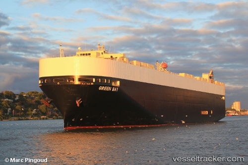
 GREEN BAY
Current Status
Where is the vessel?
GREEN BAY is currently in 174 nm NE of Munshiganj, based on AIS data received about 14h ago.
Latest AIS update:
Current position: 24.80167° N, 87.66333° W (174 nm NE of Munshiganj)
Average speed (last 7 days): Loading…
Average speed (last 30 days): Loading…
Vessel profile: GREEN BAY is a Vehicles Carrier with dimensions m x m.
This page combines live AIS, route history, probable destination signals, nearby traffic, and port activity for practical vessel monitoring.
The current position of vessel GREEN BAY is 24.80167 lat / -87.66333 lng. Updated: 2026-05-21 13:38:01 UTCCurrently sailing under the flag of United States of America ![]()
GREEN BAY built in 2007 year
Deadweight:
18312 tDetails:
Live Vessel GREEN BAY Analytics (details, animations, etc.)
Recent AIS points (UTC):
2026-05-21 09:29:10 UTC · 24.51428, -86.39665 · SOG 17.2 kn · COG -1°2026-05-21 10:38:00 UTC · 24.59333, -86.75667 · SOG 17 kn · COG -1°
2026-05-21 11:52:59 UTC · 24.67667, -87.14167 · SOG 16 kn · COG -1°
2026-05-21 13:38:01 UTC · 24.80167, -87.66333 · SOG 16 kn · COG -1°