 vesseltracker.com
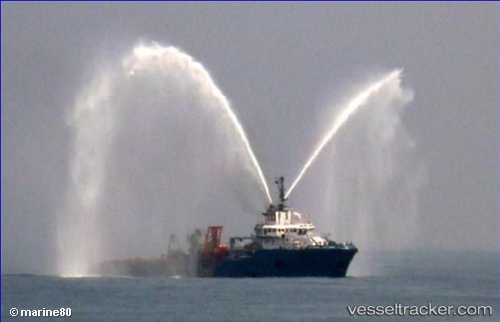
 ASGARD
Current Status
Where is the vessel?
ASGARD is currently in 24 nm NW of Saxi Batuque FPSO, based on AIS data received about 14h ago.
Latest AIS update:
Current position: 6.12786° S, 10.85432° E (24 nm NW of Saxi Batuque FPSO)
Average speed (last 7 days): Loading…
Average speed (last 30 days): Loading…
Vessel profile: ASGARD is a Anchor Handling Vessel with dimensions m x m.
This page combines live AIS, route history, probable destination signals, nearby traffic, and port activity for practical vessel monitoring.
The current position of vessel ASGARD is -6.12786 lat / 10.85432 lng. Updated: 2026-05-17 20:08:58 UTCNearest reference points:
- Near N'Kossa Terminal
- 11 nm W of Cabinda
- Near SOYO
Currently sailing under the flag of Liberia ![]()
Details:
Live Vessel ASGARD Analytics (details, animations, etc.)
Recent AIS points (UTC):
2026-05-17 15:50:15 UTC · -6.13219, 10.85354 · SOG 0.4 kn · COG 148°2026-05-17 18:03:42 UTC · -6.13352, 10.85462 · SOG 0.7 kn · COG 154°
2026-05-17 19:34:21 UTC · -6.13352, 10.85455 · SOG 0.3 kn · COG 178°
2026-05-17 20:08:58 UTC · -6.12786, 10.85432 · SOG 1.7 kn · COG 338°