.

LB flag STAR ANGIE

Vessel type: Bulk Carrier | IMO: 9340714 | MMSI: MMSI: 636019670
Call sign: D5VP3 | Dimensions: 45 m x 292 m
Current Status

Where is the vessel?

STAR ANGIE is currently in Near Cueva Bermeja, based on AIS data received about 15h ago.

Latest AIS update:

Current position: 28.41201° N, 16.19975° W (Near Cueva Bermeja)

Average speed (last 7 days): Loading…

Average speed (last 30 days): Loading…

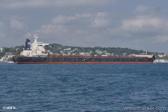
Vessel profile: STAR ANGIE is a Bulk Carrier with dimensions 45m x 292m.

This page combines live AIS, route history, probable destination signals, nearby traffic, and port activity for practical vessel monitoring.

The current position of vessel STAR ANGIE is 28.41201 lat / -16.19975 lng. Updated: 2026-05-21 01:58:43 UTC
More recent position available: 12 min ago
Free positions are delayed by 14 hours.

We recommend registering. If you register, paid vessel access will be saved in your profile. Guest access works only through a personal link.

Nearest reference points:
  • Near San Nicolás
  • Near Las Galletas
  • Near LOS CRISTIANOS

Currently sailing under the flag of Liberia LB flag

STAR ANGIE built in 2007 year

Deadweight:
177932 t

Details:

Live Vessel STAR ANGIE Analytics (details, animations, etc.)


Recent AIS points (UTC):
2026-05-20 22:12:33 UTC · 27.80944, -16.43742 · SOG 10.3 kn · COG 16°
2026-05-21 00:17:44 UTC · 28.17032, -16.31316 · SOG 11.1 kn · COG 27°
2026-05-21 01:12:22 UTC · 28.31529, -16.24218 · SOG 10.4 kn · COG 23°
2026-05-21 01:58:43 UTC · 28.41201, -16.19975 · SOG 5.4 kn · COG 347°

UTC: --
Start: -- Track timeline (UTC) End: --
Encountered: --


Link to the map:


Find another ship

STAR_ANGIE (636019670) last ports (portcalls and passsages)

DONGJIAKOU | 2025-08-29 13:13:49
PENGERANG | 2025-08-19 00:18:33
TANAH MERAH | 2025-08-17 19:48:05
BATU AMPAR | 2025-08-17 19:00:44
PULAU SAMBU | 2025-08-17 18:14:16
Trincomalee | 2025-06-06 21:19:22
Trincomalee | 2025-05-31 17:17:02
Trincomalee | 2025-05-27 08:32:06
JURONG ISLAND | 2025-05-18 15:26:41
PULAU SAMBU | 2025-05-18 00:24:35
TANAH MERAH | 2025-05-17 22:34:18
PENGERANG | 2025-05-17 21:40:35
Zhangjiagang | 2025-05-07 09:37:49
Nantong | 2025-05-07 07:26:37
Taicang | 2025-05-07 03:56:29
Wusong | 2025-05-06 12:19:07
Jingjiang | 2025-05-06 07:23:32
DONGJIAKOU | 2025-05-02 12:18:03
PENGERANG | 2025-04-20 06:21:26
TANAH MERAH | 2025-04-19 04:25:42
PULAU SAMBU | 2025-04-19 02:49:00
JURONG ISLAND | 2025-01-24 17:57:29
Singapore | 2025-01-24 16:40:42
PULAU SAMBU | 2025-01-24 16:12:08
TANAH MERAH | 2025-01-24 02:11:57
PENGERANG | 2025-01-23 23:27:46
PENGERANG | 2024-12-23 02:10:26
TANAH MERAH | 2024-12-23 01:18:03
BATU AMPAR | 2024-12-23 00:13:48
BUKOM ISLAND | 2024-12-22 23:00:56
Sao Luiz | 2024-11-12 10:44:32
Ponta da Madeira | 2024-11-10 12:08:40
Sao Luiz | 2024-11-08 09:53:22
Sao Luiz | 2024-11-04 09:41:57
Singapore | 2024-09-28 16:22:18
San Nicolas | 2024-07-31 10:42:26
San Nicolas | 2024-07-27 10:07:08
San Nicolas | 2024-07-23 09:32:58
Singapore | 2024-05-12 07:20:45
Port Louis | 2024-04-28 20:04:54
Santa Marta | 2024-03-24 16:06:05
Singapore | 2024-02-06 22:02:10
Tsugaru-Kaikyo | 2024-01-17 01:59:20
Qingdao | 2023-09-17 03:25:12
Qingdao | 2023-09-13 03:23:21
Sambu | 2023-08-30 05:50:08
Port Louis | 2023-08-13 17:06:13
Cape Of Good Hope | 2023-06-19 00:51:06
Vishakhapatnam | 2023-05-29 05:46:54
Vishakhapatnam | 2023-05-25 05:45:18
Dampier | 2023-04-03 04:59:33
Selat Lombok | 2023-03-26 19:46:14
Wusong | 2023-03-16 11:04:58
Taicang | 2023-03-16 08:43:25
Port Louis | 2023-02-11 02:39:05
Saldanha Bay | 2023-01-27 08:59:40
Paradip | 2023-01-03 08:52:49
Wusong | 2022-05-12 13:18:49